
Some of the numbers presented in this website may not be the most recent available
globalshift.co.uk - copyright © 2009 to 2026; All rights reserved


Brief history of the country
Sri Lanka (the Democratic Socialist Republic of Sri Lanka) is an island with sea borders with India (northwest) and the Maldives (southwest).
Humans date back at least 125,000 years with the indigenous Vedda still present in small numbers. Sinhalese arrived in 543 BC as migrants from Bengal.
The Buddhist Anuradhapura Kingdom was created in 380 BC. Invaded many times by other Asian dynasties, all were repelled until 1017 when Tamil Cholas sacked the city. These were driven out in 1070 and replaced by the Pollonnaruwa kingdom. In 1215 a new kingdom in Jaffna forced the Sinhalese south.
Many dynasties ruled in the south until the Portuguese began to take control from 1515. By 1619 Portugal controlled the coastal areas and the Jaffna kingdom. The Netherlands replaced them in 1656, and the UK in 1796. The Sinhalese had formed the inland Kandy kingdom in 1592 but this finally succumbed in 1815.
Now called Ceylon, it was reformed and tea plantations flourished. In 1919 movements for independence began, finally achieved in 1948. The country was renamed Sri Lanka in 1972.
The suppressed Tamils began a 26-year civil war which ended with the violent defeat of the Tamil Tigers in 2009. Sri Lanka now has an economy reliant on tourism, tea, textiles and rice plus overseas worker remittances.
Oil and gas summary
Sri Lanka lies in the Indian Ocean southwest of the Bay of Bengal. It is separated from the Indian subcontinent by the Gulf of Mannar and Palk Strait which is very shallow and includes a string of small limestone islets above sea level.
The main island comprises mostly flat and hilly coastal plains with the only mountains in the centre where the highest point is Pidurutalagala at 2,524m. Much of the the coastal waters have fringing coral reefs.
Sri Lanka lies on the Indian tectonic plate, formerly part of the Indo-Australian Plate and there are no sedimentary basins onshore except in the extreme northwest and west. Offshore intra-cratonic rift basins of the Cauvery basin (in and north of the Palk Strait), and the Mannar basin (in the Gulf of Mannar), contain thick sequences of Late Jurassic to Recent sediments.
Up to 2011 Sri Lanka had no identified indigenous oil or gas resources. However, 2 wells drilled in the deep waters of the Mannar Basin are reported to have tested gas. These, and others, may eventually become commercial developments but this is unlikely in the short and medium term.
Currently Globalshift does not ascribe any gas (or oil) production to the country due to the high commercial risk although this may change should interest by foreign companies in Sri Lanka increase.

SRI LANKA
Map and National Flag

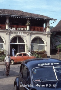
KANDY
Olde Empire Hotel
South Asia


Capital
Population
Land area (sq kms)
Oil prod (000s b/d)
Gas prod (bcm/yr)
Oil cons (000s b/d)
Gas cons (bcm/yr)
Colombo
21 mm
65,610
None
None
92
None
Government
Sri Lanka is governed by a semi-presidential system. The President is elected for a 5-year term and is head of state, commander in chief of the armed forces and head of government.
The President heads the cabinet and appoints ministers from members of parliament. The Parliament is a unicameral 225-member legislature elected for a 5-year term.
The Ministry of Petroleum Resources Development is the policy-making body responsible for oil and gas.
The Petroleum Resources Development Secretariat (PRDS) oversees all aspects of the industry.


Geology and History of Exploration
Sri Lanka lies on the Indian tectonic plate, formerly part of the Indo-Australian Plate and of Gondwanaland. In the early Mesozoic the Indian plate including Sri Lanka separated from the African, Antarctic and Australian plates and moved rapidly northeastwards.
In the Eocene the Indian plate collided with the Asian landmass creating the Himalayan mountain range in northern India. It continues to move northwards with Sri Lanka is far from the collision zone.
Onshore the country is a stable block of the Indian plate underlain almost entirely by Precambrian basement metamorphic rocks. Some limited outcrops of Jurassic sediments are present near the western coast whilst Miocene limestones underlie the northwestern shelf and a narrow belt along the onshore west coast.
Cauvery Basin - This coastline is part of the Cauvery Basin of southeast India which has been accumulating sediments from the highlands of India and Sri Lanka since the breakup of Gondwanaland.
In Sri Lanka, the Cauvery basin lies within the Palk Strait. South of a ridge that defines the Palk Strait it is called the Mannar basin.
The Mannar Basin - extends along the southern coast of India and northwest coast of Sri Lanka within the Gulf of Mannar. The basin is an intra-cratonic rift resulting from fragmentation of Gondwanaland during drifting of the Indian sub-continent away from the Antarctic plate that began in the Late Jurassic. It contains up to 6,000m of shale, sandstones and minor limestones ranging in age from Late Jurassic to Recent.
Cretaceous deep water fans provide potential reservoirs with analogues seen in east India and along the coast of East Africa. A number of sub-parallel horsts and grabens trend northeast-southwest and may form traps.
Source rocks are gas-prone. Deep water gas discoveries in the Mannar basin prove the presence of gas fields. However, none have yet proved commercially viable.
History - Petroleum exploration in Sri Lanka began in 1967 when CGG acquired 420 kms of onshore and 75 kms of offshore seismic data on behalf of the Ceylon Petroleum Corporation (CPC).
A Soviet company then acquired 4,837 kms of marine seismic data from 1972 to 1975 as well as some onshore data to evaluate the Palk Bay area in the Cauvery Basin. In 1974 the company drilled Pesalai-1 on Mannar Island, encountering gas shows in an Early Cretaceous sandstone. Two more wells were drilled nearby without success and there has been no further activity onshore.
In 1976 Western Geophysical acquired 1,947 kms of seismic data around the island and 2,829 kms in the Palk Strait and Gulf of Mannar. Marathon then drilled two exploration wells, Palk Bay-1 and Delft-1, in the Cauvery Basin targeting horst blocks but failed to encounter any hydrocarbons.
In 1981 Cities Services acquired interests in the Cauvery and Mannar basins. They collected 1,289 kms of seismic in the Gulf of Mannar and 267 kms in Palk Bay and drilled the unsuccessful Pearl-1 well on the northeast shelf of the Gulf. It penetrated a thick Late Cretaceous sandstone unit.
After ONGC discovered oil in the Indian part of the Cauvery basin, Cities Services went on to drill well Pedro-1 to search for a similar structure but failed to encounter any hydrocarbons.
Seismic data were then collected in the Mannar Basin in 1984 but no drilling was carried out and it was not until 2001 that CPC and TGS NOPEC signed a new agreement to collect 1,100 kms of seismic data followed by an additional 4,600 kms in 2005.
In 2007 the Mannar Basin was divided into 9 blocks of which 3 three were offered in a licensing round. Only Block SL2007-01-001 was licensed to Cairn India who went on to acquire seismic data and drill 4 deep water wells from 2011 to 2013. Two gas discoveries were made in 2011.
A second licensing round was launched in 2013 but this attracted only 2 bidders, neither of which acquired a license. Cairn then pulled out in 2014, unable to develop its discoveries commercially.
Total acquired a licence in 2019 to explore deep waters off the untouched east coast but at the end of 2024 no wells had been drilled offshore Sri Lanka since 2013.

SRI LANKA: SEDIMENTARY BASINS
Globalshift.co.uk (source: ResearchGate)