
Some of the numbers presented in this website may not be the most recent available
globalshift.co.uk - copyright © 2009 to 2026; All rights reserved


Brief history of the country
Samoa (The Independent State of Samoa) is a republic in the South Pacific Ocean, part of an island chain west of the Cook Islands and north of Tonga. It consists of Savai'i and Upolu plus smaller islands.
Samoa was first settled 3,500 years ago when Lapitan Austronesian people migrated eastwards from Southeast Asia. The islands were sighted by Europeans in 1722 and named the Navigator Islands in 1768. The Samoans were feared and it was not until the 1830s when German and British traders began setting up businesses.
Competing claims fuelled civil wars amongst the islanders which ended after the Tripartite Convention in 1899 when Germany and the USA divided the chain. The western islands became German Samoa while the UK gave up all claims, receiving other islands in return.
Germany governed from 1900 to 1914 when New Zealand expelled them at the request of the British. New Zealand controlled it as a trusteeship called Western Samoa.
The Mau, a non-violent movement, began to demand independence and this was granted in 1962. The name was changed to Samoa in 1997. The economy is dependent on agricultural and fishing exports with aid and overseas remittances important.
In 2011 Samoa moved time zones to the west of the International Date Line to help trade with Oceania.
Oil and gas summary
Samoa is in the Polynesian region of the Pacific Ocean and comprises rugged volcanic islands extruded into oceanic crust of the Pacific tectonic plate. Upolu and Savai'i account for 99% of the land area along with 8 small islets sitting on oceanic crust.
The Samoan volcanic island chain probably arose as the Pacific tectonic plate moved from east to west over a mantle plume known as the Samoa hotspot.
The volcanic islands and seamounts further away from the Samoa hotspot should be progressively older however, Savai'i, the western most island, suffered the most recent eruptions in Mt Matavanu from 1905 to 1911.The Saleaula lava fields on the central north coast are the result of these.
The Tonga Trench lies just to the south of the island group and it is thus likely that the Samoan volcanoes have a mixed origin associated both with the hotspot and with active subduction along this collision boundary.
Samoa has no history of production and no exploration wells have ever been drilled on land or in its surrounding waters.
Globalshift regards Samoa to have no oil and gas potential, onshore or offshore.
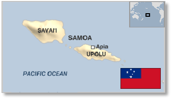
SAMOA
Map and National Flag

AUSTRALASIA
Sheltered valley
Australasia


Capital
Population
Land area (sq kms)
Oil prod (000s b/d)
Gas prod (bcm/yr)
Oil cons (000s b/d)
Gas cons (bcm/yr)
Apia
0.18 mm
2,842
None
None
1.1
None
Government
Samoa is a parliamentary democracy modified to take account of Samoan custom. The Head of State is elected by the legislature for a fixed 5-year term.
The unicameral legislature, headed by a Prime Minister, consists of 49 members serving 5-year terms of which 47 are chiefs (matai) elected from territorial districts and 2 are chosen by non-Samoans.
There is no department of government in Samoa specifically responsible for oil and gas resources.